Plan with the ground in mind.
Draw a path or calculate a terrain- or road-aware route. Inspect distance, elevation and incline before turning it into a plan.
 Teta Maps & GPS
TETA MAPS & GPS / ANDROID
Read the terrain. Build your route. Know your bearing. A connected set of maps, instruments and tracking tools for hiking, running, camping and exploring.
Start with Free. More maps with Plus & Pro.
Android · Availability varies by country.
Hiking & trekking / Running / Camping / Team fieldwork
01 / READ THE LAND
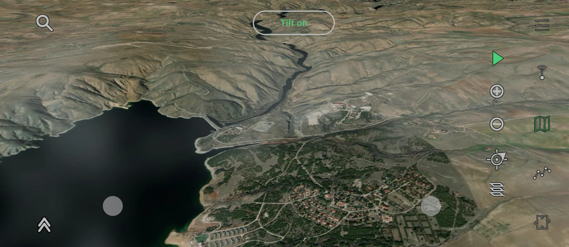
Ridges, valleys, slope and ground cover. Bring the terrain into the decision, with map layers you can actually work with.
Contours and hillshading make the relief readable. Explore OpenStreetMap-based paths, roads, water and place names, with geographic and UTM grids when you need a reference.
Teta Topo and the layer controls, captured in the app.
Plus & Pro let you download available regions before you leave coverage. Your GPS, saved places and local tools don’t need a mobile signal. Online imagery, weather and live sharing still need a connection.
Offline details02 / BEFORE, DURING & AFTER
Planning and recording belong together. Work with the route before you go, follow your progress, then understand the activity you actually completed.
Draw a path or calculate a terrain- or road-aware route. Inspect distance, elevation and incline before turning it into a plan.
See the plan and your recorded trace together. Follow completed and remaining portions, checkpoints and an approximate ETA. Resize Track to keep the map in view.
Explore elevation with incline-colored profiles and paths. Compare splits, fastest intervals, speed versus slope and optional steps, cadence and distance per step.
Pause and resume, add laps, save the result to My Places, or export your track. Plans and recordings share terrain analysis; recorded activities add timing, splits and supported step metrics.
03 / KNOW YOUR REFERENCE
Not a single heading in a corner. Dedicated GPS, Compass and Sensors tabs give you a clearer picture of where you are and how you’re moving.
Sensor availability and accuracy depend on your device and surroundings.
04 / MAKE IT YOUR MAP
The useful part of a map is what you can do with it. Keep your own geographic library, make sense of the view and share only what you choose.
MY PLACES & FILES
Organize points, paths and areas in folders. Draw and edit vertices, split or merge shapes, and create real polygon gaps. Show names and control visibility on the map.
Import and export collections with KML, KMZ and GPX. Folder structure stays meaningful; areas and their gaps travel in KML/KMZ.
AUGMENTED REALITY
Open the camera to see nearby OpenStreetMap place names over the landscape. Tap terrain for an approximate range, bearing, elevation and height difference.
Use full screen, freeze the view or align a known landmark. Readings are estimates: GPS, compass calibration and available terrain data all matter.
Camera processing stays on your device.COMMUNITY & LIVE SHARING
Find people, follow friends, exchange messages and form groups. Share tracks, landmarks, photos or field notes with geographic context.
Choose a timed live share with mutual friends or an accepted group. Manage friend markers, movement direction and recent trails in Layers.
Following or joining a group never starts location sharing.English · Türkçe · Deutsch · Français · Italiano · Español · Nederlands · Polski · Dansk
05 / CHOOSE YOUR TOOLKIT
The core field tools are in Free. Upgrade for satellite imagery and offline maps, or the complete terrain and weather toolkit.
$0 to get started
A capable map and field kit, before you subscribe.
$19.99 / year
Everything in Free, with imagery and offline preparation.
$29.99 / year
Everything in Plus, with the advanced map layers.
US reference prices shown. Google Play displays your local price, taxes, availability and subscription renewal terms before purchase. Türkiye: Plus ₺299 / 3 months or ₺599 / year; Pro ₺899 / year.
Online services have fair-use allowances, shown as percentages in the app. Offline map use requires an active Plus or Pro subscription. How fair use works ↗
A FEW PRACTICAL THINGS
Need help with maps, your account or a subscription? Write to us.
support@maps.tetasports.comWith an active Plus or Pro plan, download an available region before leaving coverage. Downloaded vector maps, available terrain and optionally downloaded imagery can then work locally. GPS positioning, saved places, recording, local analysis and available device sensors don’t need mobile data.
Imagery outside a prepared package, online weather, search and Community/live sharing need a connection. Prepare and check your downloads before a trip; not every source is included in every package.
Regional map data currently spans much of Europe, Türkiye, Georgia and the United States. App-store availability and map-data coverage are different: check Google Play for your country and the app for the region you need.
Vector and elevation coverage can differ. SRTM terrain is not available north of approximately 60°N, even where a street or topographic vector map is present. Imagery and weather also depend on their providers.
Catalog countries: Albania, Andorra, Austria, Belarus, Belgium, Bosnia & Herzegovina, Bulgaria, Croatia, Cyprus, Czechia, Denmark, Estonia, France, Georgia, Germany, Greece, Hungary, Ireland, Italy, Kosovo, Latvia, Liechtenstein, Lithuania, Luxembourg, Malta, Moldova, Monaco, Montenegro, Netherlands, North Macedonia, Poland, Portugal, Romania, Serbia, Slovakia, Slovenia, Spain, Switzerland, Türkiye, Ukraine, United Kingdom and United States.
Yes. Import KML, KMZ and GPX, including multi-feature collections. Organize the results in My Places, or export a folder or collection as one file. KML/KMZ support areas and polygon gaps; GPX is for points, routes and tracks, not polygons.
Recorded tracks and saved paths have different jobs. Converting an activity to a saved path keeps its geography and relevant elevation information without pretending it is a new GPS recording.
No. Finding someone, following them or joining a group does not share your live location. Start a timed session explicitly and choose its recipients. Recent trails and permission to save a trace are separate choices.
Live sharing needs a connection. If a phone goes offline, a displayed position can be last-known, not current. Stopping while offline cannot instantly remove a position from another device. See the Privacy Policy for the full details.
All plans have limits for online operations that incur service costs. The app shows remaining usage as percentages, not credits or currency. Paid plans have monthly and annual allowances; online work stops if either is exhausted. The usage periods start with use, rather than every app opening.
Cached data and local tools remain separate from new online work. If you hit a limit during what you believe is normal use, contact support so we can investigate.
You can explore maps and use local field tools without an account. Saved places, recordings and settings are primarily stored on your device. Account, subscription, Community and explicitly shared location features use connected services.
Camera processing for AR stays on-device; camera footage is not uploaded for recognition. Read our Privacy Policy, Terms of Use, or account-deletion instructions.
Teta Maps is a navigation aid, not an emergency service or a guarantee of safety. Maps, GPS, terrain, sensor readings, weather and AR estimates can be incomplete or inaccurate. Carry appropriate backup navigation, prepare for the conditions and contact local emergency services when needed.
YOUR NEXT DAY OUT, BETTER PREPARED.
For Android. Start with the core tools in Free.